Backpacked June 12-15, 2017
48 Miles Round Trip, 12 miles /day
Recommended Seasons: Spring May - Mid July. Fall September - Mid October.
Click this LINK for an interactive map.
Having enjoyed several day long trips along Idaho's Selway River in years past, it was only natural for us to consider it as an early season, low altitude, snow free, backpack. We were also sporting several items of new equipment so the Selway's gradual terrain and easy navigation made sense in case anything went sideways - it was an easy out should anything go wrong. What we didn't expect was the open beauty created by last years forest fire, increased sunshine, great views, abundant flowers and dense green vegetation.
Trailhead
Finding the Race Creek Campground, trailhead to Selway River Trail #4, isn't difficult, just time consuming considering how far it is from anywhere. Start by finding Highway 12 between Kooskia Idaho and Lolo Pass into Montana. Along that route is the cute tiny town of Lowell, Idaho which is also the confluence of the Selway and Lochsa Rivers creating the Middle Fork of the Clearwater River. Take the bridge across the Lochsa River and onto Route 223. Follow Route 223 to it's end and that's Race Creek Campground and Selway #4 Trailhead.
Terrain & Trail Conditions & Services
When I said the Selway River Trail is gradual don't get me wrong. It's gradual in the macro sense of rising only 630 ft in 24 miles. Looking at the trail in detail, or walking it on the ground, you'll quickly notice it rolls, sometimes steeply, up and down rising a collective 3124 ft. The surface is mostly good, sometimes rocky, often traversing steep slopes or cliffs plunging into the river. All significant streams are well bridged so we never had to wade. There were a few trees across the trail but we visited with a trail crew cutting them out.

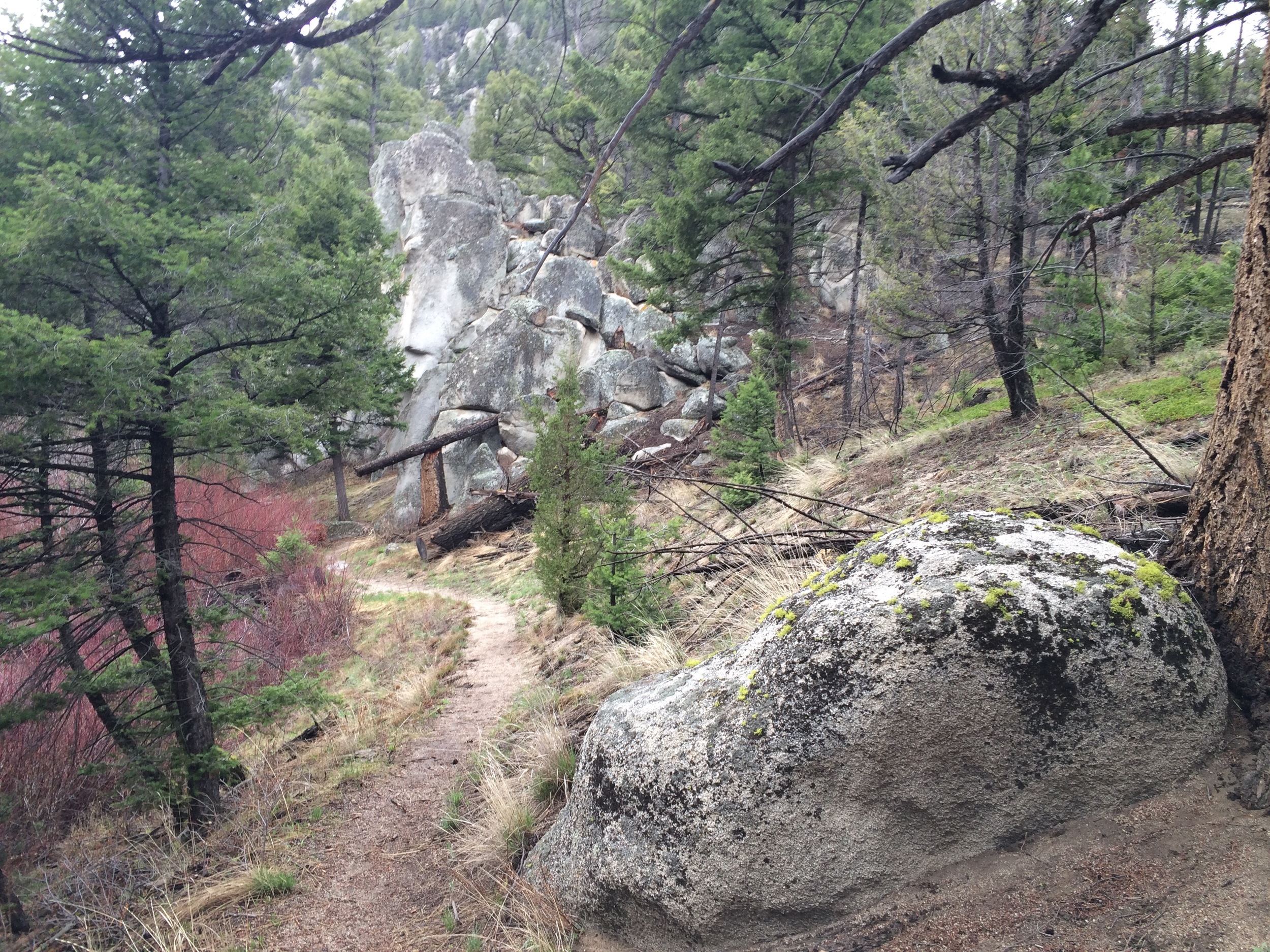
The trail traverses several cliff faces on this route.
Lowell has little in the way of groceries or other services so bring all you need. Race Creek Campground has an outhouse but no potable water. Bring it or have a way to treat water from Race Creek. There is a Forest Service Airfield at where we turned around at Moose Creek. There is a fly-in campground there and potable water. Several forest service buildings at the airfield are not open to the public but there is a Host who can answer questions and directions.
Camping options abound along the Selway River Trail but their density reduces the farther you are from the trailhead. The same is true for water sources all of which are surface streams.
Wildlife
We wouldn't call The Selway River Trail a wildlife trail per se. We did see several deer, numerous small mammals, a garter snake and many bird species while hiking. Black bear scat was fairly common as were elk and moose tracks but we didn't see any of those critters. In years past we've seen rattlesnakes and porcupine along the trail but not this trip and they are rather easily avoided when encountered. We suggest keeping dogs under physical control to avoid mishaps.

This garter snake is one of several wildlife species we saw, or saw sign of, during our hike.
Vegetation
The Selway River Trail excels at views and diverse vegetation. We had heard rumor the trail was 'green tunnel hiking' and were pleasantly surprised to find it untrue. A forest fire last year opened up much of this trail and renewed some nutrients for flowering plants. When where we live in Montana was just getting ready to bloom, the Selway was in full show.

Clarkia, one of the wildflowers blooming in early June.
Conclusions
We feel the Selway River Trail is an excellent option for early season backpacking. Especially for novices interested in honing skills or experienced folks testing new gear or wanting to get in shape for summer outings. Camping sites are common, water sources plentiful, tail conditions are good and there's enough going on to keep one's interest high.